

The first section of the trip went well. We felt as if we were making better time on the bike than with the Honda. The deer flies were terrible. We had applied copious amounts of repellent prior to our start. This kept the beasties from biting, but not from dive bombing our heads. Quite irritating but much preferred over being bit. Once again we encountered bunnies in droves. For some reason they seemed more intolerant of the bikes than of the car. A lot of the foliage was in bloom, most of which I was not familiar with.

After crossing the first bridge things definitely got more interesting. The cinders that made up the road bed were larger and more pronounce than on the first section. They tended to slip out from under your tires giving a very unstable feel to the ride. We seemed to get much reduced traction and it made the bike difficult to control. My bike seemed to negotiate the rocks a bit better than Janette’s possibly due to the slightly wider tires. I found that the faster I went the easier it was to negotiate the rocks although it took a bit to disregard the unstable feel of the ride. Janette's method was to partially dismount and to kick the bike along like a scooter. This terrain lasted to the second bridge.
I rode directly across the bridge which; for me, was a bit unsettling. Janette opted to walk, by far the better idea. The bridge is very stable but just the nature of the event makes it a bit weird. Play the video and see for yourself.
The remainder of the trip was much easier. Thankfully the roadbed was much more solid and we finished the journey in good time. Not a lot to see on the far end. To the south are farm fields and to the north back water and swamp. A few trails lead into the bush, but I imagine they lead to oil and gas leases as we saw on our first trip. Maybe that will be an adventure for another day. A lot of night shade growing along this section of the trail. It was just loaded with ripe berries. I was surprised at the lack of birds. I would expect them to be feasting all through there. A ways down the trail we ran into a friend from town walking her very large and thankfully, well behaved black lab. They were quite cordial but we did not stop to chat.


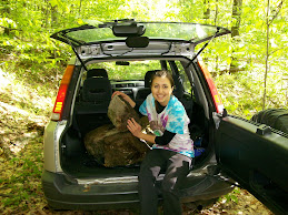
A large gate blocked entrance to the far end of the trail as it spilled out on to the farms valley road, equipment shed next to it belied the idea that the road was well maintained due to the oil leases on the property. Janette and I rode south meeting up with the east valley road and returned to Coryville.

It was a pleasant ride back. The hills for the most part were merciful and we made great time. There were some unexpectedly beautiful homes on that section of road which made trip back even more enjoyable. The rough road in the swamp did cause me to hammer the seat all the way down on the bike frame. Too tired to mess with it, I finished the trip with an uncomfortable pedal stroke.
While crossing the bridge at potato creek about 100 yards from the car I heard a pop and my tire went flat. Finished the trip on foot but at least I finished.


In retrospect I would like to spend more time on the far side of the trail. Possibly another adventure, definitely during hunting season.


2 comments:
you guys are so brave!!! what are you going to do without her???
http://maps.google.com/maps?f=d&saddr=Port+Allegany,+PA&daddr=W+Mill+St+%4041.808590,+-78.285451+to:T408+%4041.731086,+-78.296306+to:T409+%4041.768057,+-78.261146+to:41.742627,-78.237419&hl=en&geocode=1741805798230693011,41.808590,-78.285451%3B2070579943785595969,41.731086,-78.296306%3B10188984120156818921,41.768057,-78.261146&mra=dme&mrcr=1&mrsp=4&sz=12&via=1,3&dirflg=w&sll=41.770031,-78.272781&sspn=0.12086,0.220757&ie=UTF8&z=12
This is where Janette and I trekked to on our way to Buck's house. We went WAY off course. But Janette's thought of going through Portage was not impossible...
Post a Comment