Saturday, August 30, 2008

Spring up Oh well!

Our many thanks to my co-worker Robert (Bob) Bailey who clued us in to this adventure. He is truly an adventurer at heart. He spends many hours around the break room and water fountain regaling the masses with his own tales of daring do. He is an avid outdoorsman with all the trophies to prove it. He mentioned to me the existence of an artesian well in our area. His claims of volumes of ice cold water spewing from a pipe in the earth peaked my interest. He gave preliminary instruction on reaching the area. I knew of the area he mentioned but I had rarely visited it and had never explored much beyond the parking area.


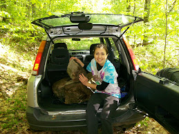
On the third of August, Janette and I set off late in the afternoon to search for the illusive well. The parking area we started from was a stone’s throw from the Prospect radio tower. This is a well known landmark as it can be seen for miles perched atop one of the highest hills in the area. The State Game lands parking area is famous with hormonal teens and locals who consider drinking beer and listening to Coyotes howl a sport. A dug road just off the lot leads into the valley on the west side of the mountain. It runs clear to skinner creek road and is closed to motorized traffic.


The road was well maintained and had seen heavy equipment recently. Some of the heavy brush on the edge of the road had been cleared (mowed actually). The area looked to be an overgrown orchard more than forest; the apples were plentiful but still green and bitter. The road descended through a small stand of hemlocks and into more a forest proper. Lots of black cherry and in the clearings between the trees were thickets of berry bushes. Red raspberries were just finishing up; the few that were left were very sweet. The black berries were just beginning to come on and the bushes were loaded with unripe fruit. We enjoyed a few as we searched for our stream.


Our information was that our stream would come in from our left as we traveled down the road it would cross to the right and continue down the valley. The sides of the road were majorly overgrown which could make it difficult to find this stream. I figured that the stream would have to be fairly good size if it was to live up to my friends tales. We continued on our way marveling at the fauna as we went. We came across a tree with clusters of unripe berries. We were clueless as to the identification, as well as a tree that looked to be similar to a horse chestnut only smaller. I would have liked to have a field book handy to aid with the ID.


As we continued I did notice a small stream to our left as predicted. It looked way too small to be fed by the legendary well. We continued downstream to try and confirm that this was indeed the waterway we were seeking. It crossed under the road to the right and then back to the left. The culverts construction betrayed some serious water flow. The amount of water was consistent and sparse, we found it hard to believe the well was indeed the source.


We had traveled almost a mile since it had first crossed the road. The stream was deep in the valley and we decided it had to be what we were looking for. We convinced ourselves that the low levels were due to the dry conditions. With little rain in many weeks the water table had dropped to a point that threatened the existence of the stream. We headed back up the trail determined to find the source and our well.


We buoyed our spirits with several handfuls of berries from the sides of the trail. We noticed that within a few weeks the blackberries would be in full fruit. It is definitely worth a picking adventure with MJ and Danae. We could tell by the droppings in the roadway that the bears were taking good advantage of the crop already. One pile was a bit disconcerting being that it consisted entirely of long black hair. This bear had killed and eaten either a cub or a possibly a large dog. There were no noticeable bone fragments so it was probably a larger animal (i.e. not a squirrel). I have heard that male bears will not tolerate other males of any age in their territory. A possible answers albeit not one I am not anxious to solve.


We arrived at the spot where we first noticed the stream. We left the trail and continued to follow through the woods. To our surprise the stream did not head up the hill but crossed back to the opposite side of the road. We had not seen it due to the thick underbrush on the side of the trail. And more likely we were preoccupied with wildflowers and berries rather than with looking for the stream.


We were hot and tired. The trail is deceptively steep and the hike out was more than we anticipated. With no artisan spring water to slake our thirst we decided to call it a day. We vowed to return armed with more information and our berry buckets.


Epilogue:
Lots of Coyote dropping and bear poop. Probably best not to tell MJ and Danae about this when we invite them on the next trip in. We discussed purchasing a spray can of mace. I hear in grizzly country they call it “hiker seasoning”.
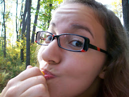
I like eating green(unripe) apples as I am more a fan of sour than sweet. My method too avoid a sore tummy consists of masticating the fruit to extract all the flavor then, expelling the pulp. It's not pretty but it works.

Friday, August 1, 2008

Coryville Swamp – The rest of the story!

Janette and I got a fairly early start, for us anyway. Loaded our bikes on the back of the Honda and headed into adventure. The morning mist was just starting to burn off as we arrived at the Coryville Railroad crossing. Janette used her mom’s bike, originally she intended to use a sturdier model but mechanical difficulties prevented her. I had just outfitted the adventure bike with a GPS, pedometer and machete so I was anxious to see how it handled.


The first section of the trip went well. We felt as if we were making better time on the bike than with the Honda. The deer flies were terrible. We had applied copious amounts of repellent prior to our start. This kept the beasties from biting, but not from dive bombing our heads. Quite irritating but much preferred over being bit. Once again we encountered bunnies in droves. For some reason they seemed more intolerant of the bikes than of the car. A lot of the foliage was in bloom, most of which I was not familiar with.


After crossing the first bridge things definitely got more interesting. The cinders that made up the road bed were larger and more pronounce than on the first section. They tended to slip out from under your tires giving a very unstable feel to the ride. We seemed to get much reduced traction and it made the bike difficult to control. My bike seemed to negotiate the rocks a bit better than Janette’s possibly due to the slightly wider tires. I found that the faster I went the easier it was to negotiate the rocks although it took a bit to disregard the unstable feel of the ride. Janette's method was to partially dismount and to kick the bike along like a scooter. This terrain lasted to the second bridge.


I rode directly across the bridge which; for me, was a bit unsettling. Janette opted to walk, by far the better idea. The bridge is very stable but just the nature of the event makes it a bit weird. Play the video and see for yourself.


The remainder of the trip was much easier. Thankfully the roadbed was much more solid and we finished the journey in good time. Not a lot to see on the far end. To the south are farm fields and to the north back water and swamp. A few trails lead into the bush, but I imagine they lead to oil and gas leases as we saw on our first trip. Maybe that will be an adventure for another day. A lot of night shade growing along this section of the trail. It was just loaded with ripe berries. I was surprised at the lack of birds. I would expect them to be feasting all through there. A ways down the trail we ran into a friend from town walking her very large and thankfully, well behaved black lab. They were quite cordial but we did not stop to chat.


A large gate blocked entrance to the far end of the trail as it spilled out on to the farms valley road, equipment shed next to it belied the idea that the road was well maintained due to the oil leases on the property. Janette and I rode south meeting up with the east valley road and returned to Coryville.


It was a pleasant ride back. The hills for the most part were merciful and we made great time. There were some unexpectedly beautiful homes on that section of road which made trip back even more enjoyable. The rough road in the swamp did cause me to hammer the seat all the way down on the bike frame. Too tired to mess with it, I finished the trip with an uncomfortable pedal stroke.
While crossing the bridge at potato creek about 100 yards from the car I heard a pop and my tire went flat. Finished the trip on foot but at least I finished.


Epilogue: Total trip was 8 miles. Distance to the first bridge was half a mile. Distance to the trestle was one mile. The distance through the swamp was just about two and a half miles. I used a GPS and a pedometer on the bike. They seem to work fairly well especially after you turn them on. Across the farmers valley road from the gate is a sign post marked "rail trail". I imagine this leads into Smethport following the same railbed. Maybe we will check it out someday.
In retrospect I would like to spend more time on the far side of the trail. Possibly another adventure, definitely during hunting season.