Did you ever see a road and just want to know where led. I did and I decided to find out where it went. I drove past it every day as I took a detour to work. It was a small dirt road beside a railroad track that disappeared into a swamp. I was intrigued and thought that this has the makings of an adventure. Janette had wanted to go fishing but it had been a rainy week and the water was up. Not bad enough to preclude fishing but just enough to make me decide to explore this road instead.  Saturday morning we took off. Headed through Turtlepoint on the back way to Corryville. We crossed Marvin Creek just south of the village and stopped at the railroad grade where the road begins. Seeing no postings or warnings to stay off the road we headed west toward Smethport. The road was narrow with just enough room for the car. At one section the Multiflora Rose and Mulberries were so thick that they pushed the side mirrors flat against the car. Rabbits were everywhere, cottontails raced us down the road in short stretches before veering off into the thick underbrush.
  The bed of the road was fairly clear seemingly seeing much use from what I expect would be ATV’s. The foundation of the road reminded me of a railroad grade made up mostly of golf ball sized porous cinder. About three quarters of a mile in we encountered a low flat railroad bridge. Confirming our thoughts as to the origin of the road. The bridge bed had been replaced with railroad ties probably from the original tracks. It seemed sturdy and solid so we crossed. A side road on the far side of the bridge looked recently mowed so we followed it on foot for several hundred yards. We found a couple of gas wells and returned to our vehicle to continued our journey.
 The growth was even thicker further on . The railroad bed became uneven and we encounter much more debris. At one point a fallen tree limb almost precluded our passage but we were just able to get under it. We were now well over a mile into the swamp. The road just seems to go on forever. Straight as an arrow with overgrown backwater coves on either side. I was entertaining the idea of turning back when I realized that there was not enough room to maneuver the Honda around. The rail bed took an abrupt rise and out of the thicket emerged a large train trestle. At the entrance to which were side roads and thankfully, enough area to turn around.
 Saturday morning we took off. Headed through Turtlepoint on the back way to Corryville. We crossed Marvin Creek just south of the village and stopped at the railroad grade where the road begins. Seeing no postings or warnings to stay off the road we headed west toward Smethport. The road was narrow with just enough room for the car. At one section the Multiflora Rose and Mulberries were so thick that they pushed the side mirrors flat against the car. Rabbits were everywhere, cottontails raced us down the road in short stretches before veering off into the thick underbrush.
  The bed of the road was fairly clear seemingly seeing much use from what I expect would be ATV’s. The foundation of the road reminded me of a railroad grade made up mostly of golf ball sized porous cinder. About three quarters of a mile in we encountered a low flat railroad bridge. Confirming our thoughts as to the origin of the road. The bridge bed had been replaced with railroad ties probably from the original tracks. It seemed sturdy and solid so we crossed. A side road on the far side of the bridge looked recently mowed so we followed it on foot for several hundred yards. We found a couple of gas wells and returned to our vehicle to continued our journey.
 The growth was even thicker further on . The railroad bed became uneven and we encounter much more debris. At one point a fallen tree limb almost precluded our passage but we were just able to get under it. We were now well over a mile into the swamp. The road just seems to go on forever. Straight as an arrow with overgrown backwater coves on either side. I was entertaining the idea of turning back when I realized that there was not enough room to maneuver the Honda around. The rail bed took an abrupt rise and out of the thicket emerged a large train trestle. At the entrance to which were side roads and thankfully, enough area to turn around.
  This span crossed over a section of Potato Creek and is much longer then the first bridge. The bed of the bridge was of the same construction as the last but much more deteriorated. Metal post had been installed to keep large vehicles from crossing. Across the bridge the trail continued as straight as before and as far as we could see. The bugs were somewhat severe and were quickly draining us of fluids. We decided to leave the discovery of the other end of the trail for another day.
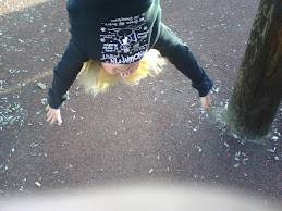
On returning to the vehicle I noticed a male ruff grouse in the roadway. I let out a few turkey clucks and he seemed to respond. I called for Janette to bring the camera and document the event. I continued to cluck and the bird got increasingly agitated. His amourous advances were direct toward Janette.
When good grouse go bad. I am not sure whether my expert calling offended the animal or Janette’s rendition of the “bird dance”. Either way, the bird’s aggression was turned toward Janette. The above video is not for the squeamish or the faint of heart. Parental discretion is advised.


Epilogue: The following day I purchased a good quality bug spray. It is in the “Adventure Bag” to stay. The flora of the narrow roadway was brutal to the finish of our Honda CRV. I had to promise Mary Janette that I would give it a wash and wax this week. Hence forth, due to this trial by fire, the Honda CRV will be known as the “Adventure Car”. Janette is seeing a therapist to work through the issues regarding the grouse attack. We are expecting a full recovery. The night mares are already starting to subside.